iCYLON turns complex, unstructured information into clear, connected intelligence. By ingesting data from documents, PDFs, and web sources, iCYLON automatically uncovers critical entities and the relationships between them. The result is structured, searchable data that powers faster insights, deeper analysis, and smarter decisions across even the most challenging information environments.
How It Works
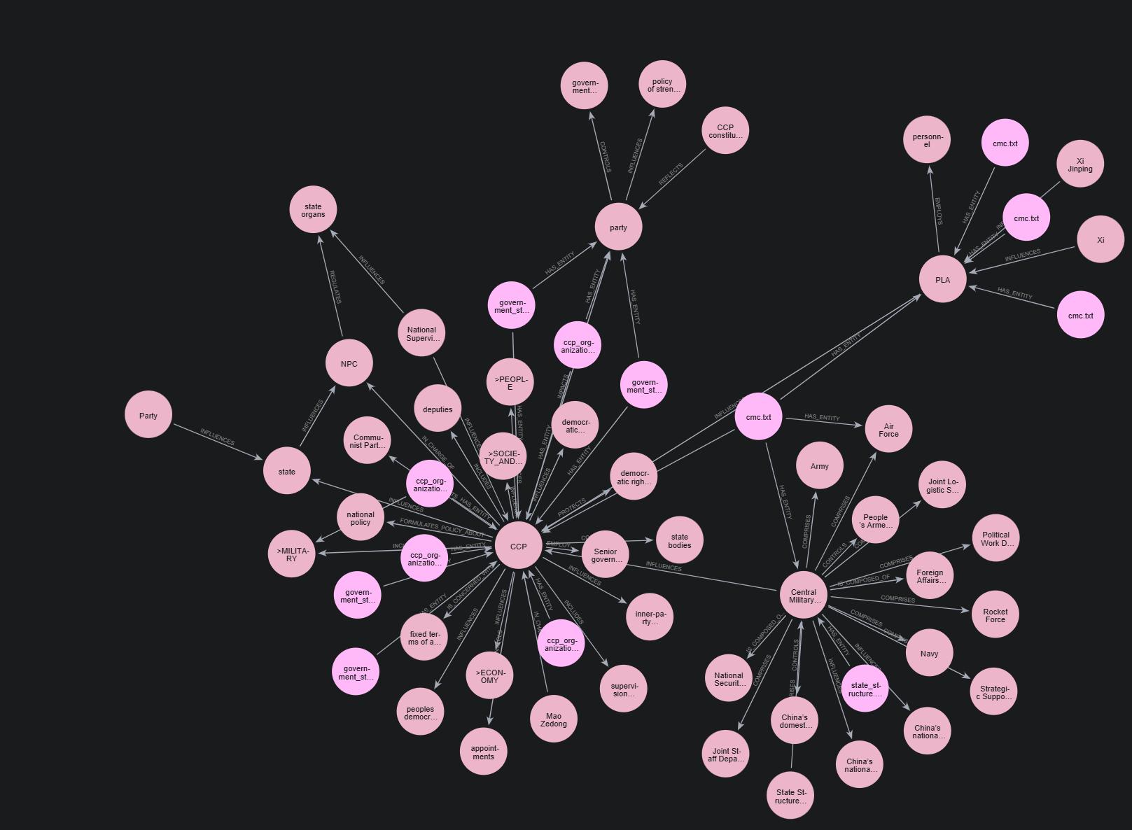
We analyze datasets to identify and organize key topics into a clear, hierarchical structure. Using AI and large language models, we then determine meaningful relationships between those topics and concepts.
This structure becomes a defined schema that guides how entities and relationships are extracted from each document. The result is a refined set of nodes and connections that can be further optimized by identifying and merging semantically similar elements—creating a cleaner, more accurate, and more powerful knowledge graph.
Exquisite datasets represent 5 Billion+ nodes and 4 Billion+ relationships in a graph database. Exquisite Datasets can be licensed or subscription can be purchased.
MDpedia
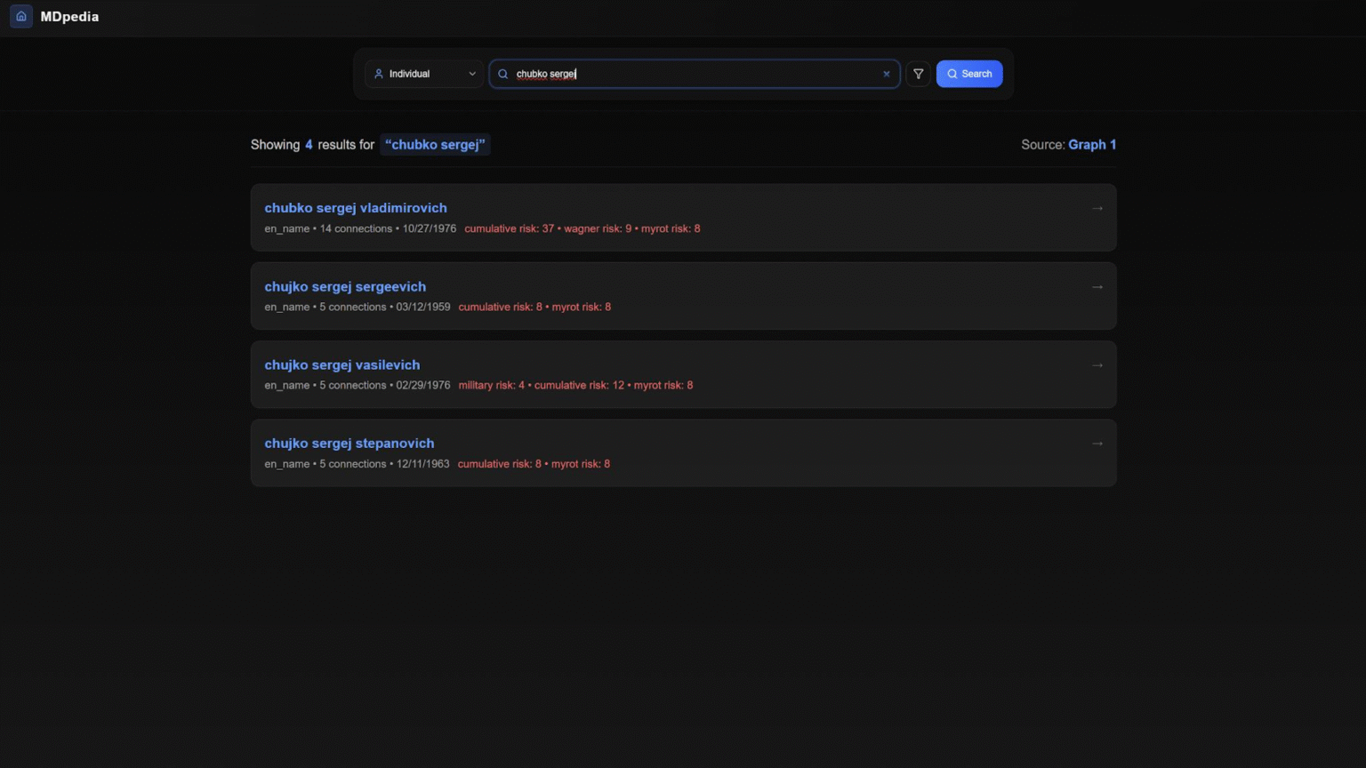
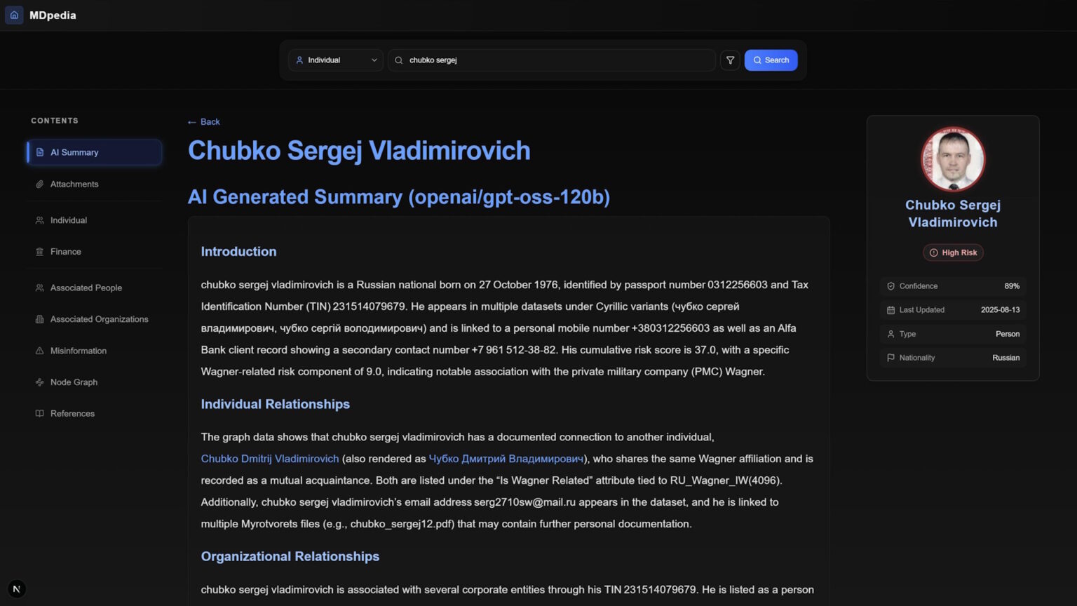
MDpedia is an advanced reporting platform that uses a Neo4j graph database to dynamically generate comprehensive, interconnected reports. Users can search for individuals, organizations, or bank accounts and instantly access detailed report pages that include AI-generated summaries, profiles, supporting documents, references, and interactive graph visualizations. Every section clearly identifies its source within the Neo4j graph, allowing users to easily trace all information back to its original data node for full transparency and confidence.
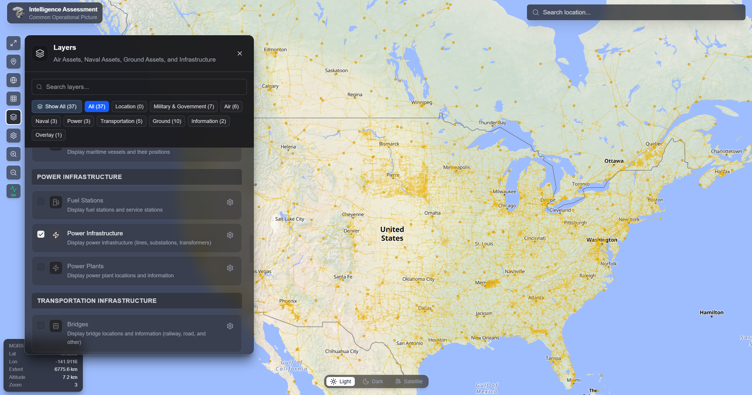
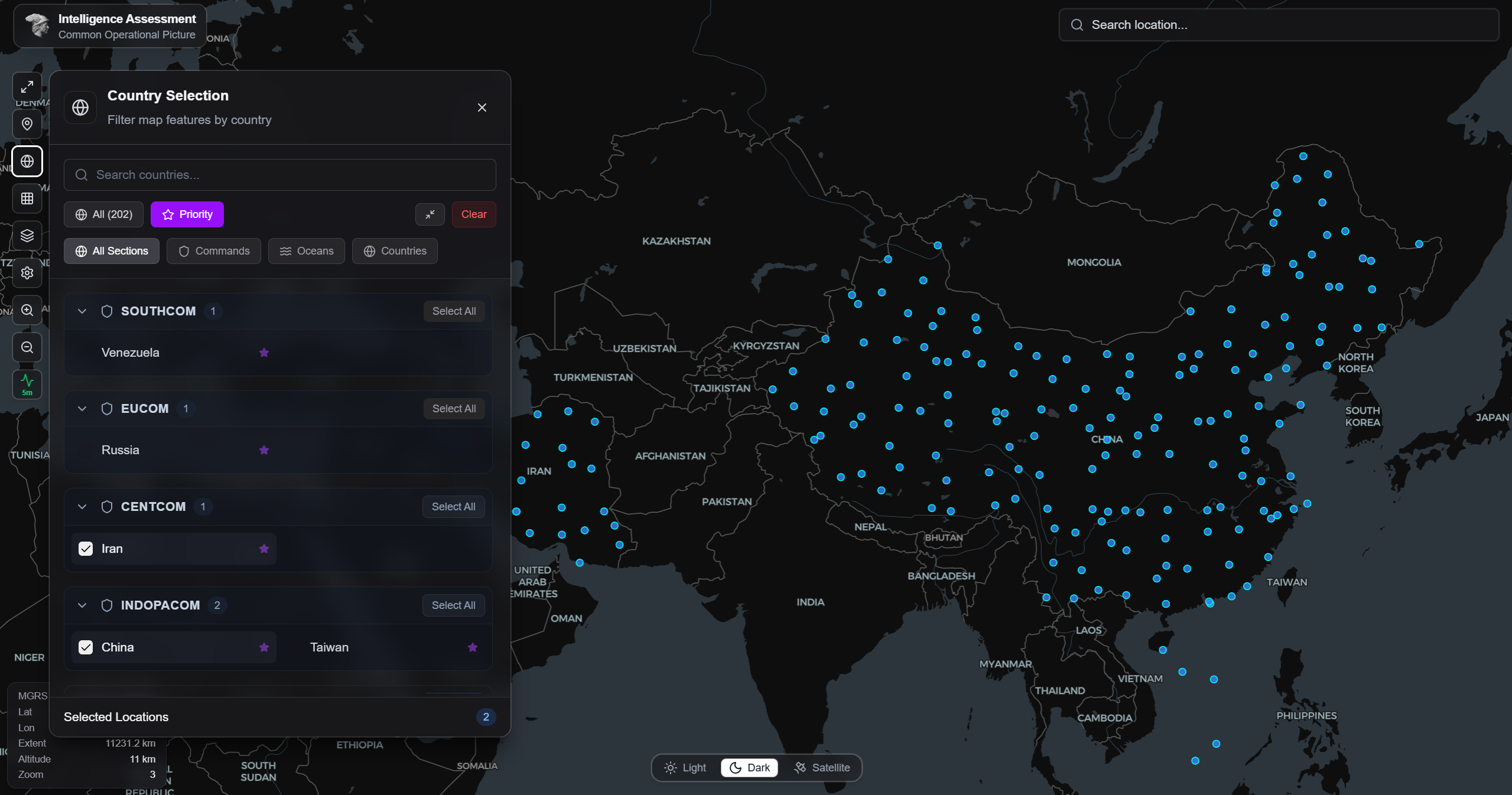
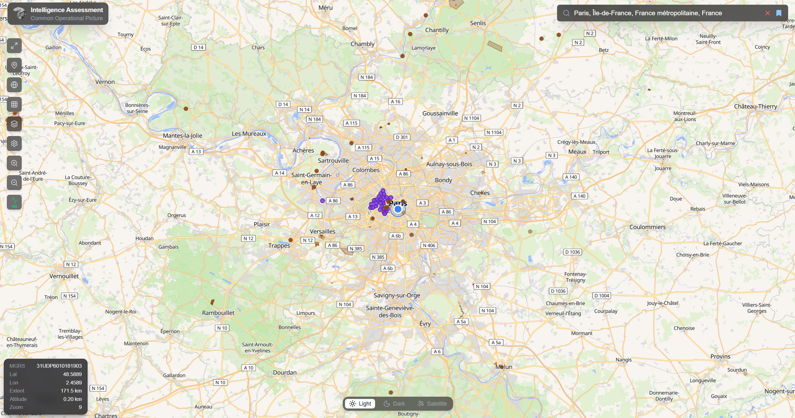
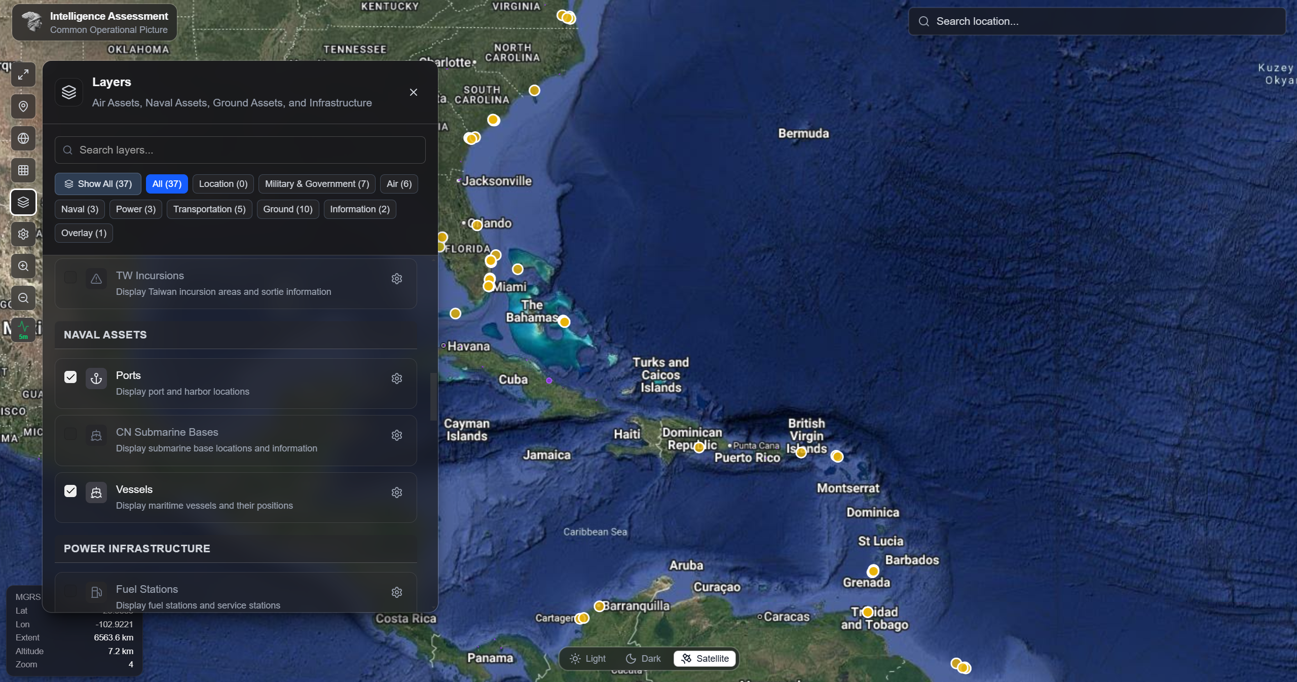
Common Operational Picture (COP)
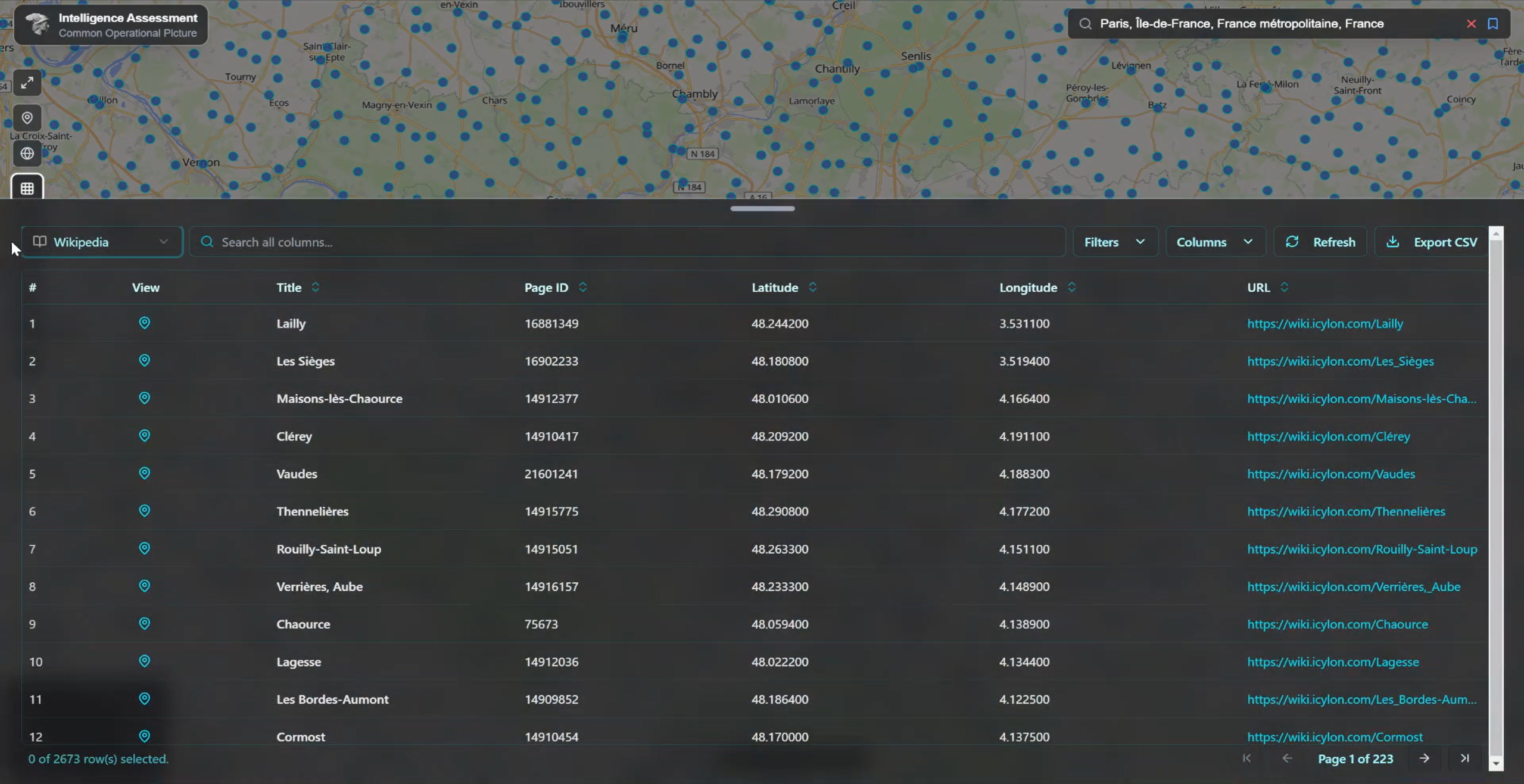
COP provides a real-time, interactive view of global infrastructure data designed for geospatial analysis and situational awareness. It organizes proprietary and open datasets by category, supports global search with advanced filtering, and enables users to focus on specific regions or countries. With strong accessibility features, flexible use of OpenStreetMap (OSM) data—including raw data when needed—and easy export of selected datasets into tables, COP supports deeper analysis and informed decision-making.
Want to learn more? Contact Us and schedule a demo.